


by James L. Ward, ASLA

Phillips Community in Mt. Pleasant, South Carolina, Traditional Cultural Property Designation
Traditional Gullah communities along the South Carolina coast are coming under increasing threat as sprawling development, global sea level rise, and changing economic pressures are testing their ability to adapt. Until the establishment of the Gullah Geechee Cultural Heritage Corridor in 2006, these places were overlooked and frequently marginalized as part of the South Carolina landscape—becoming a vestigial shadow of the post-Civil War African American culture. Today they are valued for their ongoing traditions and the determination of the people who inhabit them. The pressures of change, however, are unrelenting and precipitate new tools for the continued preservation and vitality of traditions dating from the European settlement and Native American influences.
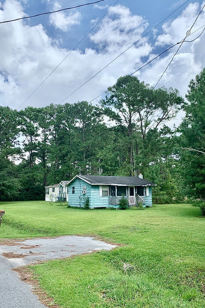
Rather than the usual kind of material preservation measures that emphasize the buildings, these places speak to the interrelationships of people and the landscape. We talk less about integrity of built forms and more about the continuity of a culture. Their ties to the past are displayed in their extant property boundaries reflecting their family and community ties (still guided by the elders of the community at and after church services), the relationship to the water and tidal marsh for the vitality of their arts and crafts traditions (famously portrayed by their sweetgrass baskets), and their agriculture and foodways (the basis of much of Southern cooking). Finding a way to value and preserve these features requires a new approach.
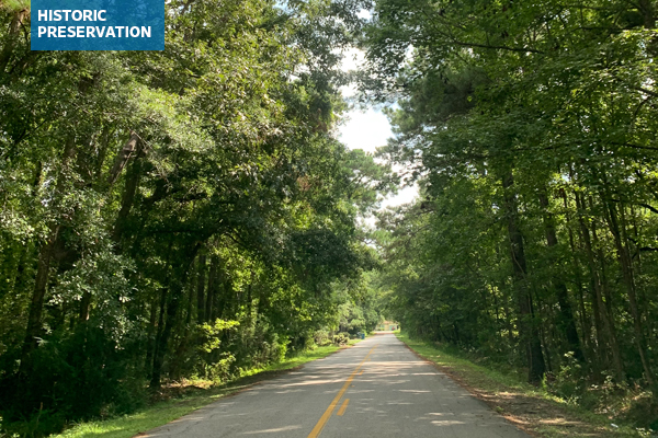
One such threatened place is the Phillips Community, a 401-acre post-Civil War settlement site on Highway 41 in Mt. Pleasant, SC, directly adjacent to Horlbeck Creek, which is part of the Wando River watershed, just east of Charleston, SC. Over the last few decades, it has been surrounded by new, mixed-use residential neighborhoods and a connecting highway, traversing the heart of the community. As in many other such situations, this has not only fragmented the area, but it has also created issues with traffic and safety, drainage and flooding, and access to the water and marshes.

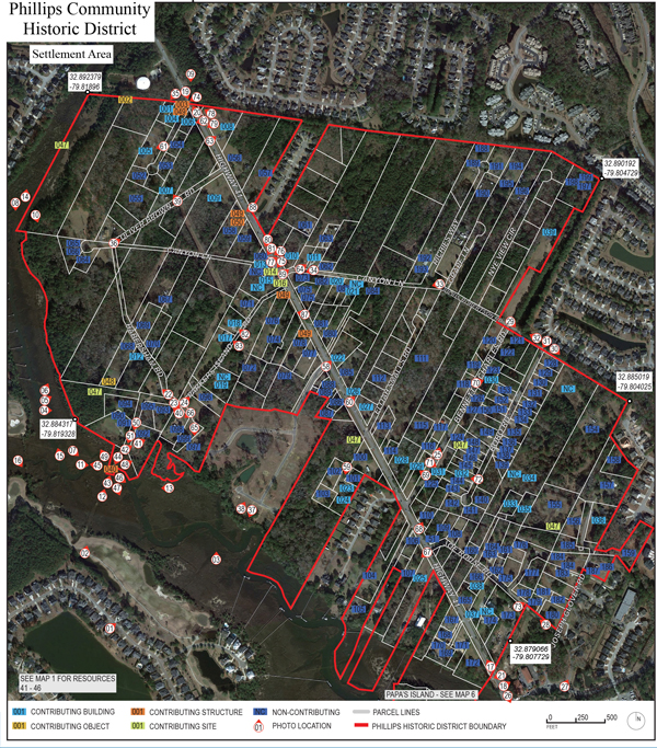
Consequently, the elders of the communities came together to try to protect their traditions for future generations. Supported by the Coastal Conservation League, Historic Charleston Foundation, and the Preservation Society of Charleston, with able assistance from BVL Historic Preservation Research, the neighborhood started telling their story in its many details and nuances. These oral histories provided direction for archival research and documentation required for completing a National Register of Historic Places nomination form—much of the story told in cemeteries, lot lines, drainage patterns, agricultural fields, and sweetgrass and seafood harvesting locations.

The nomination was for the community’s continued “association and feeling” with the Gullah culture. It also serves as an important milestone for continuing efforts to protect this place and to provide guidance for future generations. Moreover, Phillips Community is now the first Historical Overlay District for a relatively new kind of preservation called a Traditional Cultural Property. Long used to help preserve the Native American traditions in the West, it is a relatively new arrival in the Eastern US. It is the only such district in Charleston County and has proven immediately useful to counter the proposals from South Carolina Department of Transportation for widening Highway 41 and to influence the planning of this expanding part of Mt. Pleasant. It is not fully resolved as a planning instrument, but it is a start.
Finally. this project highlights the new professional context for landscape architects to work in, requiring consideration of the culture of a place as well as natural and built system analyses. For example, there are still issues in negotiating with the parties and issues in an environmentally and politically sensitive area. The Southern Environmental Law Center is documenting these efforts as it becomes a template for planning in the future. Identifying and documenting these places is what cultural landscape studies are about. This is an important new direction for landscape architectural practice, creating new places that respect the culture of a place and new considerations needed for landscape practice.
James L. Ward, ASLA, a landscape architect since 1981, has worked in South Carolina, Georgia, and Bermuda, with experience in various firms and government roles. Initially trained in English Literature, he earned his BLA and MLA from the University of Georgia. His career spans projects at Kiawah Island and Seabrook, downtown Charleston developments, and managerial roles at LS3P and PBS&J. Ward served as the Landscape Architect for the Government of Bermuda, overseeing numerous construction projects. Returning to academia, he taught at the College of Charleston and Clemson University, specializing in historic preservation and community planning. James now focuses on landscape design, emphasizing preservation and community, serving on boards, and actively participating in ASLA initiatives.
